National Trails Day 2025
Saturday, June 7
*Pre-Registration Required*
Return later for more details on how to Register
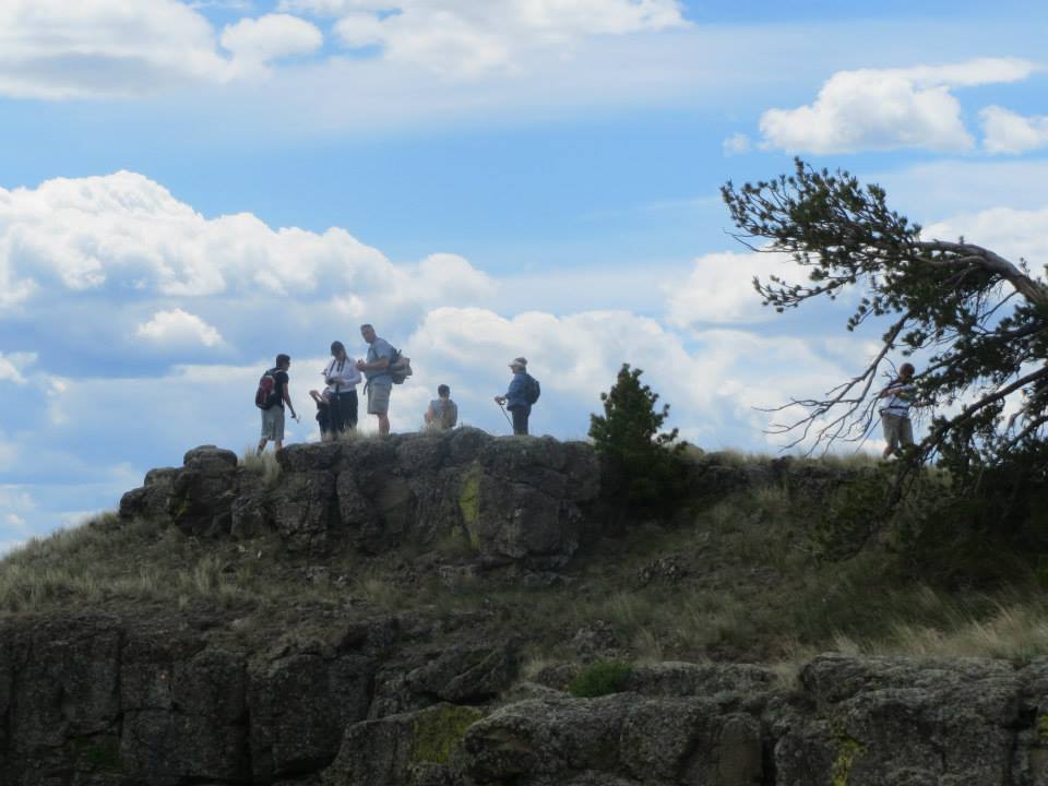
GREAT FALLS – Kick-start your summer outdoor activities by celebrating National Trails Day on Saturday, June 7, 2025. Choose from a variety of hikes planned in the Rocky Mountains, Highwood Mountains, Plains, along the Missouri River, and on local Great Falls area trails. This one-day event is hosted by Get Fit Great Falls, a not-for-profit organization advocating healthy, active lifestyles. We want to thank this year’s sponsor, Scheels and Bighorn Outdoor Specialists, for their support! National Trails Day is celebrated across the nation, but Great Falls historically is one of the largest. As a courtesy to landowners and fellow hikers, participants are asked to leave their dogs at home.
On-line registration is required and begins Wednesday, May 24 and runs through June 2. To register and view the hikes go to www.getfitgreatfalls.com/hikes. The hikes are free, but space is limited and the number of participants varies with each hike. In past years, registrations for particular hikes have filled quickly, so make sure to sign up soon!
Hikes range from kid-friendly to strenuous depending on miles hiked and/or elevation gained. Hikers are asked to read the hike descriptions carefully before selecting a trail to fit their physical conditioning. Those recovering from physical challenges, families with children in strollers or folks just starting to get into shape should check out the shorter walks and hikes labeled “easy” or described as “stroller-friendly.” Those seeking a more challenging experience should watch for hikes labeled “moderate or difficult.” Get Fit Great Falls reminds registrants selecting a hike to “Understand your skill level about hiking and your physical fitness level. A difficult five-mile hike in mountainous terrain is much more challenging than walking 5 miles on the flat paved sidewalks of Great Falls.”
Be sure to read where the hike departs. Hikes will depart from Gibson Park but a few will meet at a trailhead. Hikers are advised to arrive 15 minutes before their scheduled time to meet their hike coordinator. Some hikes require driving to a trailhead others depart directly from Gibson Park. Detailed descriptions for each hike are available from a link at www.getfitgreatfalls.com/hikes.
Volunteer guides and Montana State Parks, Bureau of Land Management, and USDA Forest Service rangers will be leading the hikes. These volunteers and state and federal partners help make National Trails Day all the more special, as most of the hikes traverse public land.
It is advised that participants come prepared with a daypack, lunch, plenty of drinking water, closed-toed shoes, sunscreen and rain gear, as most hikes happen regardless of weather. In the past, June showers have not dissuaded participants, and the sun has often broken through the clouds for a beautiful day of hiking. Experienced hikers believe in the adage, “There are no bad hiking days, only bad clothes.”
Hike descriptions are as follows (remember to register by clicking here):
Windy Mountain Loop
Length: 7 miles
Elevation gain: 1200 feet
Meet: 8:00am at Gibson Park Band Shell
Total time: 5-6 hours
Travel Distance to Trailhead: Approximately 40 miles from GF
Age limit: 13 and up in good shape; children with legal guardian
Max. Number: 12
Difficulty Level: Moderate, Difficult based on length
Coordinator: Sean Higginbotham
Note: Bear spray recommended
Take a hike in the Highwood Mountains! This hike starts at Thain Creek Campground and will lead you through forest, vast open meadows which should be speckled with seasonal flowers, and below craggy peaks. We will climb about 1200 feet to the meadows surrounding the south face of Windy Mountain on this moderate 7 mile loop hike. Bring gear for variable weather, lunch, snacks, water, pack and sturdy shoes for hiking.
Rogers Peak
Length: 4 miles
Elevation gain: 1500 feet
Meet: 8:15am at Gibson Park Band Shell
Total time: 6 – 7 hours (hike and drive time)
Travel Distance to Trailhead: Approximately 70 miles
Age limit: 16 and up in good shape; children with legal guardian
Max. Number: 12
Difficulty Level: Difficult based on steepness
Coordinator: Mike Dannells and Sarah Mizener
Note:
Join Mike Dannells and Sarah Mizener for a hike on the CDT to the top of Rodger’s Peak. The wildflowers should be out (and ticks) but the views are worth it. The hike climbs moderately over two miles with views into the Bob Marshall and Holter Lake on a clear day and see where the plains meet the mountains. Minor stream crossings could be a bit muddy so waterproof or old boots help.
Notes/Advisory: This is grizzly bear country; please bring bear spray and be bear aware. This is an early season hike, so there may be sections of trail that are snow covered.
Clary Coulee–Rocky Mt. Front
Length: Approximately 4.5 miles total
Elevation gain: 1600 feet, (160 flights of stairs)
Meet: 8 a.m. Gibson Park Bandshell to coordinate caravan
Total time: 6 hours
Travel Distance to Trailhead: 85 miles, 1.75 hours, 3 miles on gravel road
Age limit: 8 and up in good shape; children with legal guardian
Max. Number: 13
Difficulty Level: Difficult
Coordinator: Travis Rixford
Note: Bear spray required
This is a great hike in the foothills of the Rocky Mountain Front that ends with a fantastic view of the plains. We will hike an established Forest Service trail that passes through remnants of an old wildfire and various segments of timbered forest. The area offers an abundance of wildflowers, birds, and small and large mammals. Please be sure to bring good, preferably waterproof, hiking boots, rain gear, backpack with three liters of water, sunscreen, and high energy snacks and food. The hike is rated as difficult based on elevation gain, so it is important that all hikers be in shape and used to walking over uneven terrain and have good ankle strength. Notes/Advisory: This is grizzly bear country; please bring bear spray and be bear aware. This is an early season hike, so there may be sections of trail that are snow covered or muddy.
Tower Rock State Park
Length: Approximately 4 miles round trip
Elevation gain: approx. 400ft, (40 flights of stairs)
Meet: 9 a.m. Gibson Park Bandshell to coordinate caravan
Total time: 45 minute drive to trailhead then 2 Hours on the trail
Travel Distance to Trailhead: 36 miles to trailhead
Age limit: 8 and up in good shape; children with legal guardian
Max. Number: 20
Difficulty Level: Moderate/Moderate Difficult
Coordinator: Gerry and Chuck Jennings and Mike Smith and Dave Wilsey
Note: Bear spray optional, not stroller friendly
Join the Island Range Chapter of Wild Montana on this hike at Tower Rock State Park. The hidden gem was a stop on Lewis and Clark’s Corps of Discovery in July of 1805. You will hike the first half mile along a single track maintained trail then follow your guides off trail as you continue up to the top saddle of the Rock. Once at the top be sure to take in the view of the prairie expanding to the north as the Missouri River leaves the Adel Mountains. Along the way notice how the plant life changes from prairie flora to mountain flora. Be sure to watch for wildlife in the area including Bighorn Sheep. Please be sure to bring hiking boots, rain gear, water bottle, sunscreen, and high energy snacks and food. The hike is rated as moderate difficult based on elevation gain and steep off trail travel, so it is important that all hikers be in shape and used to walking over uneven terrain and have good ankle strength. Notes/Advisory: This is bear country; be bear aware. Rattlesnakes also inhabit the area.
Sulphur Springs
Length: 3.6 miles
Elevation gain: 500 feet, (50 flights of stairs)
Meet: 9:00 AM Gibson Park
Total Time: 4 hours
Travel Distance to Trailhead: 17 miles from GF
Age limit: 8 and up with legal guardian
Max. Number: 15
Difficulty Level: Moderate
Coordinators: Ray Tetreault and Cortney Reedy
Sulphur Springs Trail is part of the Lewis & Clark Trail. It starts at a trailhead next to the Morony Dam (17 mile drive Northeast of Great Falls). Starting from the trailhead, it is a 1.8 mile hike to the Springs site. The terrain crosses through several small coulees. The trail follows the river through a rocky, native prairie landscape. This hike is a guided interpretive walk with topics ranging from native plants to the Lewis and Clark expedition.
On this hike you have to be in good physical shape; please bring insect repellent, hiking boots, backpack with about 2 liters of water, sunscreen, and high-energy snacks and food. We will hike at a moderate pace. The distance is 3.6 miles round trip, which we will cover in about three hours. We will take a snack break at the springs.
Hikers can expect great views and possibly wildlife, including rattlesnakes. Insect repellent is suggested as there are ticks and mosquitoes: a true Lewis and Clark experience! The hike coordinators are Ray Tetreault and Cortney Reedy, both staff at the Lewis and Clark National Historic Trail Interpretive Center.
Kiddos Playdate Walk
Length: Less than 1 mile
Elevation gain: None.
Meet: 9:30 am at Gibson Park
Travel Distance to Trailhead: Depart from Gibson Park
Total Time: 1.5 hours
Age limit: None; children with legal guardian
Max. Number: 20
Difficulty Level: Easy
Coordinators: Alex and Erin Sholes
Join Erin, Alex, and their little ones for a play time with your children. Plan on a short walk from Gibson Park to a play area where activities will keep your little one active and engaged in fun, fun, fun, including sidewalk chalk drawing! This walk is designed for pre-school to second-grade children. All children must be accompanied by an adult.
Kiddos and Grown Ups Walk
Length: 3 miles
Elevation gain: none
Meet: 10:00 a.m. at Gibson Park
Total time: 2 hours
Travel Distance to Trailhead: Depart from park
Age limit: None
Max. Number: 20 children
Difficulty Level: Easy
Coordinator: Miranda Murray
Note: Tennis shoes or good walking shoes required (no flipflops, please)
Grab your parents and join Miranda for a hike across the Central Avenue West walking bridge, then on to West Bank Park to the playground structure that Get Fit Great Falls helped to install a few years ago.
There are places to stop and take a look at the water, plants, trees etc. This hike is wheelchair and stroller accessible and is designed for children who are active and inquisitive. Children must be accompanied by an adult. Put on your tennis shoes (no sandals please) and come join the fun!
FPBJ Hike
Length: 3 miles
Elevation gain: 400 feet
Meet: 10am Gibson Park Total time: 2.5 hours
Travel Distance to Trailhead: 13.5 miles to park visitor center where we meet
Age limit: all ages welcome
Max. Number: 25
Difficulty Level: moderate
Coordinator: Andy Keller
Note: Trail is not suitable for strollers
The hike will focus on how the multiple tribes that used First Peoples Buffalo Jump communicated within their tribes and across tribes. You will also learn about how the whole Buffalo Jump Hunt took place. The hike will offer expansive views across the prairie and a chance to see prairie wildflowers in bloom as well as some of the native prairie animals that call this state park home.